
 Asset Publisher
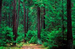
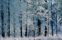
Polish forests
 fot. Paweł Fabijański
 fot. Paweł Fabijański
 fot. Paweł Fabijański
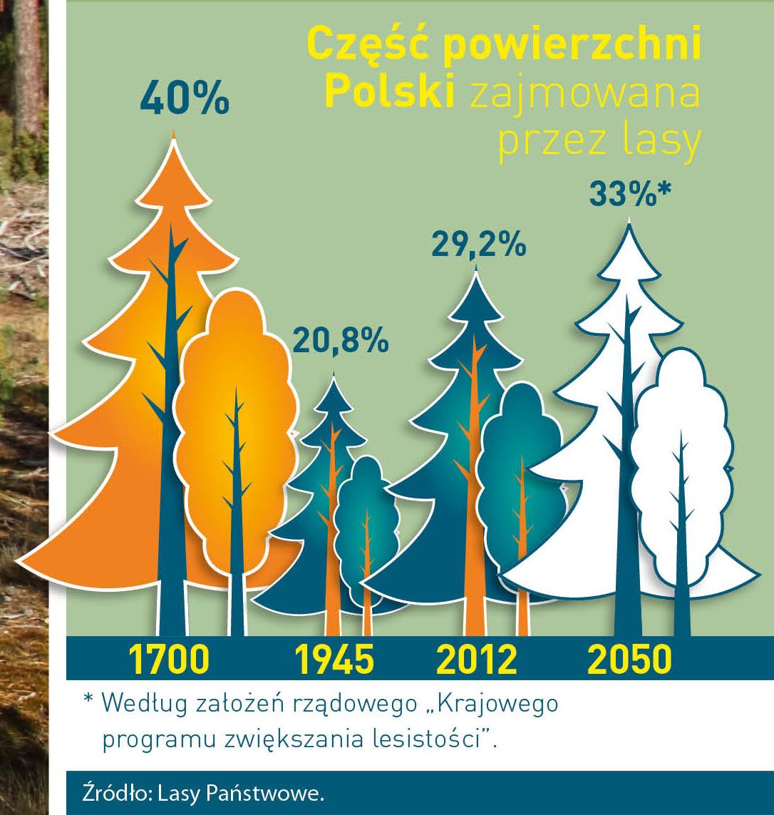
Poland is in the European lead, while concerning the area of all forests. They cover about 29,2 % of the country territory, and grow within the area of 9,1 million hectares. The overwhelming majority of the forests is state owned, of which almost 7,6 million hectares are managed by the State Forests National Forest Holding..
The number of Polish forest is still growing. The forestation rate of the country has increased from 21 % in 1945 to 29,2 % at the moment. Between 1995 and 2008, the forest area increased by 310 thousand ha. The basis for afforestation works is the "National Programme for Increasing the Forest Cover" (KPZL), assuming an increase of the forestation rate up to 30 % by 2020 and up to 33 % by 2050. Polish forests abound in flora, fauna and fungi. 65 % of the total number of animal species live there.
The forests grow in our country on poor soils, mainly because of the development of the agriculture in previous years. It influences the distribution of the types of the forest sites in Poland. Over 55 % of the forest areas is covered with coniferous forests. In other areas, there are forest sites, mainly the mixed ones. Their small part constitute alder and riparian forests – not more than 3 %.
In the years 1945 – 2011 the area of natural deciduous tree stands within the area of the State Forests National Forest Holding increased from 13 to 28,2 %.
Within the lowlands and uplands the most often occurring tee species is pine. It covers 64,3 % of the forest area of the State Forests National Forest Holding and 57,7 % of private and commune forests. In the mountains the predominant species is European spruce ( in the west) and European spruce with beech (in the east). Domination of pine is the result of carrying on sustainable forest management in the past. Once, the monocultures (crops or cultivations of one species) were the answer to the great demand of industry for wood. Such forests appeared to be quite fragile to climatic factors. They also were often the prey of pests' expansion.
In Polish forests, the share of other tree species, especially deciduous trees have been systematically increasing. The foresters have stepped aside from monocultures – that is why, they try to fit specific species of the forest stand to the natural stand, that would be proper for the given area. Thanks to that, in the years 1945 – 2011, the area of the deciduous tree stands within the lands of the State Forests National Forest Holding increased from 13 to 28,2 %. There occur more and more frequently the following tree species: oaks, ashes, maples, sycamore maples, elms, but also birches, beeches, alders, poplars, hornbeams, aspens, tilias and willows.
Our forests are the most often represented by the forest stands aged 40 to 80 years. The average age of the forest equals 60 years. More and more trees are of big size at the age over 80 years. Since the end of the Second World War, the forests' area has increased up to almost 1,85 million hectares.
Raport o stanie lasów w Polsce 2012
Asset Publisher


Asset Publisher
informacje ogólne
informacje ogólne
Przestrzenne usytuowanie Nadleśnictwa Łobez oraz krótki rys historyczny.
Nadleśnictwo Łobez w aktualnych granicach zostało utworzone z dniem 1.10.1972 r. na podstawie Zarządzenia Nr 24 Dyrektora OZLP w Szczecinie z dnia 20.09.1972 w sprawie zmian w strukturze administracyjnej przez połączenie dwóch poprzednio istniejących Nadleśnictw Łobez i Węgorzyno.
Nadleśnictwo Łobez składa się z dwóch obrębów leśnych: obrębu Łobez i obrębu Węgorzyno.
Powierzchnia ewidencyjna Nadleśnictwa bez współwłasności wg zestawienia powierzchni działek wynosi: 23 028,2864 ha, w tym obrębu leśnego Łobez – 10 936,8318 ha, obrębu leśnego Węgorzyno – 12 091,4546 ha.
Obszar Nadleśnictwa Łobez wg „Regionalizacji przyrodniczo – leśnej Polski” (Zielony R. Kliczkowska A. 2012 r.) położony jest w I Krainie Bałtyckiej, Mezoregionie Pojezierza Choszczeńskiego, Równiny Słupskiej, Mezoregionie Pojezierza Drawskiego oraz w III Krainie Wielkopolsko-Pomorskiej, Mezoregionie Równiny Drawskiej.
Siedziba położona jest dość korzystanie względem zasięgu terytorialnego. Najdalej od siedziby Nadleśnictwa położone są leśnictwa Ińsko, Ginawa. Wszystkie leśnictwa mają kontakt z Nadleśnictwem przez telefony komórkowe i stacjonarne. Transfer danych z rejestratora do bazy SILP dokonywany jest za pomocą sieci telefonicznej.
Położenie Nadleśnictwa Łobez, jego zasięg terytorialny oraz odległości od siedziby Nadleśnictwa do poszczególnych organów administracji przedstawiono na wycinku mapy administracyjnej.

Mapa przedstawia Nadleśnictwo Łobez
Warunki klimatyczne
Klimat obszaru nadleśnictwa jest pod silnym wpływem klimatu atlantyckiego, co skutkuje łagodnymi zimami, niezbyt gorącymi latami z bardzo dużą ilością opadów. O wpływie klimatu kontynentalnego świadczą powtarzjące się okresy suszy wiosennej oraz często występujące spóźnione przymrozki. Niepokojącym zjawiskiem jest wzrost przeciętnej rocznej temperatury, malejąca ilość dni z pokrywą śniegu oraz wzrost liczby dni z anomaliami pogodowymi powodującymi wzrost ilości i siłę wiatrów huraganowych.
Typy siedliskowe lasu
Na terenie nadleśnictwa przeważają siedliska lasowe – 92,6 %, siedliska borowe stanowią zaledwie 7,4%. Dominujące typy siedliskowe lasu to las mieszany świeży – 42,9% i las świeży – 36,5%. Udział olsów, łęgów oraz siedlisk bagiennych wynosi 9,7%. Mimo, że przeważają siedliska lasowe, to dominującym gatunkiem lasotwórczym jest sosna (ok. 46 %), następnie buk (ok. 15%) i dąb (ok. 9 %).
Nadleśnictwo Łobez w liczbach
Przeciętna zasobność drzewostanów wynosi 234 m3/ha
Rocznie pozyskanie grubizny wynosi ok. 107 tys. m3
Przeciętny wiek drzewostanów wynosi 56 lat.
Przeciętna powierzchnia leśnictwa wynosi ok. 1770 ha